Description
- Sensors: GPS, Galileo, QZSS, Compass, GPS Compass
- Dimensions: 2.04″ x 3.90″ x 1.03″ (5.17 x 9.90 x 2.61 cm)
- Display Size: 0.9″ x 0.9″ (23 x 23 mm)
- Display Resolution: 176 x 176 pixels
- Display Type: Sunlight-readable, monochrome, transflective memory-in-pixel (MIP)
- Weight: 3.5 oz (100 g)
- Battery Type: Rechargeable internal lithium-ion
- Battery Life: Up to 30 days at 30-minute tracking send interval with standard activity recording with full sky view
- Water Rating: IPX7
- Interface: USB-C
- Flexible Satellite Airtime Plans available
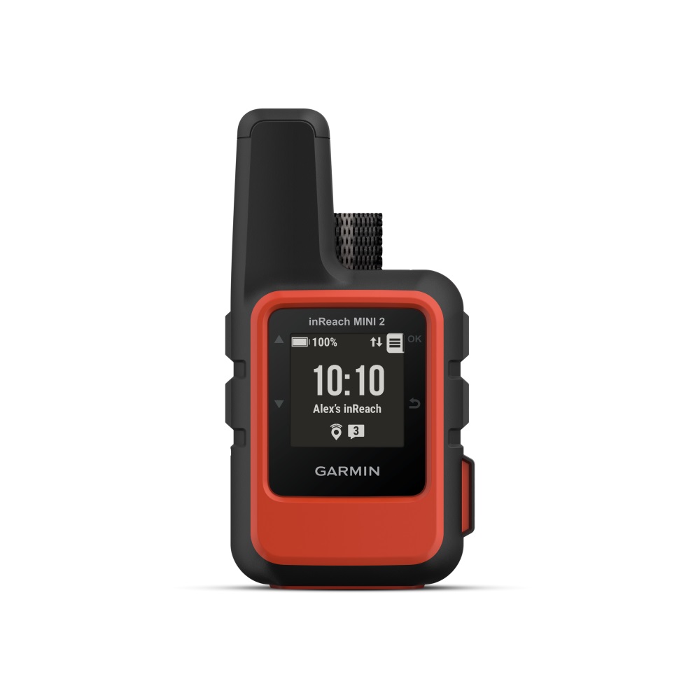
This compact satellite communicator helps to stay in contact with home even when off the grid – adding peace of mind to every adventure.
Global satellite coverage keeps a connection when mobile phones can’t, In an emergency, send an interactive SOS message to our coordination centre. Keep in connect to the ones who matter, even without mobile phone coverage. With TracBack routing, retrace the track back to avoid getting lost.
Expand the capabilities of the inReach device by using the Garmin Explore app. Stay on adventures longer with up to 14 days of battery life in 10-minute tracking mode. Stay in touch using inReach technology.
Stay in touch using inReach technology
Two-Way Messaging: Exchange text messages with loved ones back home, post to social media, or communicate inReach to inReach in the field.
Interactive SOS Alerts: In case of emergency, trigger an interactive SOS message to the Garmin IERCC, a 24/7 staffed emergency response coordination centre.
Location Sharing: Share location with loved ones back home at any time using the MapShare page or embed coordinates in messages.
Global Satellite Network: Instead of relying on mobile phone coverage, Messages, SOS alerts and location tracking are transferred via the global Iridium® satellite network.
Flexible Satellite Airtime Plans: To access the Iridium network and communicate with the inReach Mini 2, an active satellite subscription is required. There are options for an annual package or a flexible month-to-month plan.
Compact, Rugged Design: Compact at just 4″ x 2″ size and 100g weight, the inReach Mini 2 is tough, durable, impact resistant (MIL-STD-810) and water-rated to IPX7.
The Adventure-ready companion
Tracback Routing: The TracBack routing feature navigates back to a starting point – right on the device.
Digital Compass: Get accurate heading information – even when not moving.
Battery Life: The internal, rechargeable lithium battery gives up to 14 days use at the default 10-minute tracking mode and up to 30 days in power saving mode.
InReach Weather Forecast Service: Get detailed weather updates on inReach Mini 2 or a paired compatible device. Request forecasts for current location or other waypoints or destinations on the route itinerary.
Unlimited Cloud Storage and Trip Planning: Get free access to the cloud-powered Garmin Explore website from any computer to plan trips, create preset messages and quick texts, sync and manage device settings, and much more.
Connect to more capabilities
Garmin Explore App: Sync with the Garmin Explore website or the mobile app on any compatible smartphone for navigation, waypoints, courses, activities and collections. Also get access to trip planning and topographical mapping.
Other Garmin Devices: Remotely control inReach Mini 2 to send and receive messages, start and stop tracking, and trigger an interactive SOS using compatible Garmin handhelds, wearables or other mobile devices.
Garmin Pilot App: Pair with the Garmin Pilot app to easily send and receive text messages from the cockpit – even without mobile reception. The app can use the inReach Mini 2 device’s GPS position and location sharing abilities for the flight.
